Basic Information
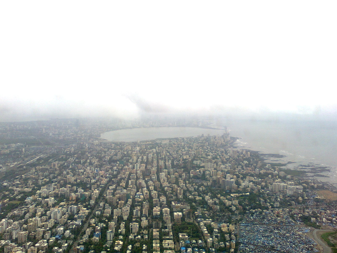
Mumbai , formerly Bombay, is the capital city of the Indian state of Maharashtra. It is the most populous city in India, and the fourth most populous city in the world, with a total metropolitan area population of approximately 20.5 million. Along with the neighbouring urban areas, including the cities of Navi Mumbai and Thane, it is one of the most populous urban regions in the world. Mumbai lies on the west coast of India and has a deep natural harbour. In 2009, Mumbai was named an Alpha world city. It is also the wealthiest city in India. and has the highest GDP of any city in South, West or Central Asia.
Sources:
http://en.wikipedia.org/wiki/Mumbai
Sources:
http://en.wikipedia.org/wiki/Mumbai
Geography
Mumbai consists of two distinct regions: Mumbai City district and Mumbai Suburban district, which form two separate revenue districts of Maharashtra. The city district region is also commonly referred to as the Island City or South Mumbai. The total area of Mumbai is 603.4 km2 (233 sq mi). Of this, the island city spans 67.79 km2 (26 sq mi), while the suburban district spans 370 km2 (143 sq mi), together accounting for 437.71 km2 (169 sq mi) under the administration of Brihanmumbai Municipal Corporation (BMC). The remaining area belongs to Defence, Mumbai Port Trust, Atomic Energy Commission and Borivali National Park, which are out of the jurisdiction of the BMC.
Mumbai lies at the mouth of the Ulhas River on the western coast of India, in the coastal region known as the Konkan. It sits on Salsette Island, partially shared with the Thane district. Mumbai is bounded by the Arabian Sea to the west. Many parts of the city lie just above sea level, with elevations ranging from 10 m (33 ft) to 15 m (49 ft); the city has an average elevation of 14 m (46 ft). Northern Mumbai (Salsette) is hilly, and the highest point in the city is 450 m (1,476 ft) at Salsette in the Powai–Kanheri ranges. Sanjay Gandhi National Park (Borivali National Park) is located partly in the Mumbai suburban district, and partly in the Thane district, and it extends over an area of 103.09 km2 (39.80 sq mi).
Apart from the Bhatsa Dam, there are six major lakes that supply water to the city: Vihar, Lower Vaitarna, Upper Vaitarna, Tulsi, Tansa and Powai. Tulsi Lake and Vihar Lake are located in Borivili National Park, within the city's limits. The supply from Powai lake, also within the city limits, is used only for agricultural and industrial purposes. Three small rivers, the Dahisar River, Poinsar (or Poisar) and Ohiwara (or Oshiwara) originate within the park, while the polluted Mithi River originates from Tulsi Lake and gathers water overflowing from Vihar and Powai Lakes. The coastline of the city is indented with numerous creeks and bays, stretching from Thane creek on the eastern to Madh Marve on the western front. The eastern coast of Salsette Island is covered with large mangrove swamps, rich in biodiversity, while the western coast is mostly sandy and rocky.
Soil cover in the city region is predominantly sandy due to its proximity to the sea. In the suburbs, the soil cover is largely alluvial and loamy. The underlying rock of the region is composed of black Deccan basalt flows, and their acidic and basic variants dating back to the late Cretaceous and early Eocene eras. Mumbai sits on a seismically active zone owing to the presence of 23 fault lines in the vicinity. The area is classified as a Seismic Zone III region, which means an earthquake of up to magnitude 6.5 on the Richter-scale may be expected
Sources:
http://en.wikipedia.org/wiki/Mumbai#Geography
Climate
Mumbai has a tropical climate, specifically a tropical wet and dry climate under the Köppen climate classification, with seven months of dryness and peak of rains in July. The cooler season from December to February is followed by the summer season from March to June. The period from June to about the end of September constitutes the south-west monsoon season, and October and November form the post-monsoon season.
Between June and September, the south west monsoon rains lash the city. Pre-monsoon showers are received in May. Occasionally, north-east monsoon showers occur in October and November. The maximum annual rainfall ever recorded was 3,452 mm (136 in) for 1954. The highest rainfall recorded in a single day was 944 mm (37 in) on 26 July 2005. The average total annual rainfall is 2,146.6 mm (85 in) for the Island City, and 2,457 mm (97 in) for the suburbs.
The average annual temperature is 27.2 °C (81 °F), and the average annual precipitation is 2,167 mm (85 in). In the Island City, the average maximum temperature is 31.2 °C (88 °F), while the average minimum temperature is 23.7 °C (75 °F). In the suburbs, the daily mean maximum temperature range from 29.1 °C (84 °F) to 33.3 °C (92 °F), while the daily mean minimum temperature ranges from 16.3 °C (61 °F) to 26.2 °C (79 °F). The record high is 40.2 °C (104 °F) on 28 March 1982, and the record low is 7.4 °C (45 °F) on 27 January 1962.
Sources:
http://en.wikipedia.org/wiki/Mumbai#Climate
Retrieved from Wikipedia
|
Retrieved from www.micro2macro.net
|
Transport
Public transport systems in Mumbai include the Mumbai Suburban Railway, Brihanmumbai Electric Supply and Transport (BEST) buses, black-and-yellow meter taxis, auto rickshaws and ferries. Suburban railway and BEST bus services together accounted for about 88% of the passenger traffic in 2008.
Rail:
The Mumbai Suburban Railway, popularly known as Locals forms the backbone of the city's transport system
Bus:
Mumbai's bus services carried over 5.5 million passengers per day in 2008. Public buses run by BEST cover almost all parts of the metropolis, as well as parts of Navi Mumbai, Mira-Bhayandar and Thane.
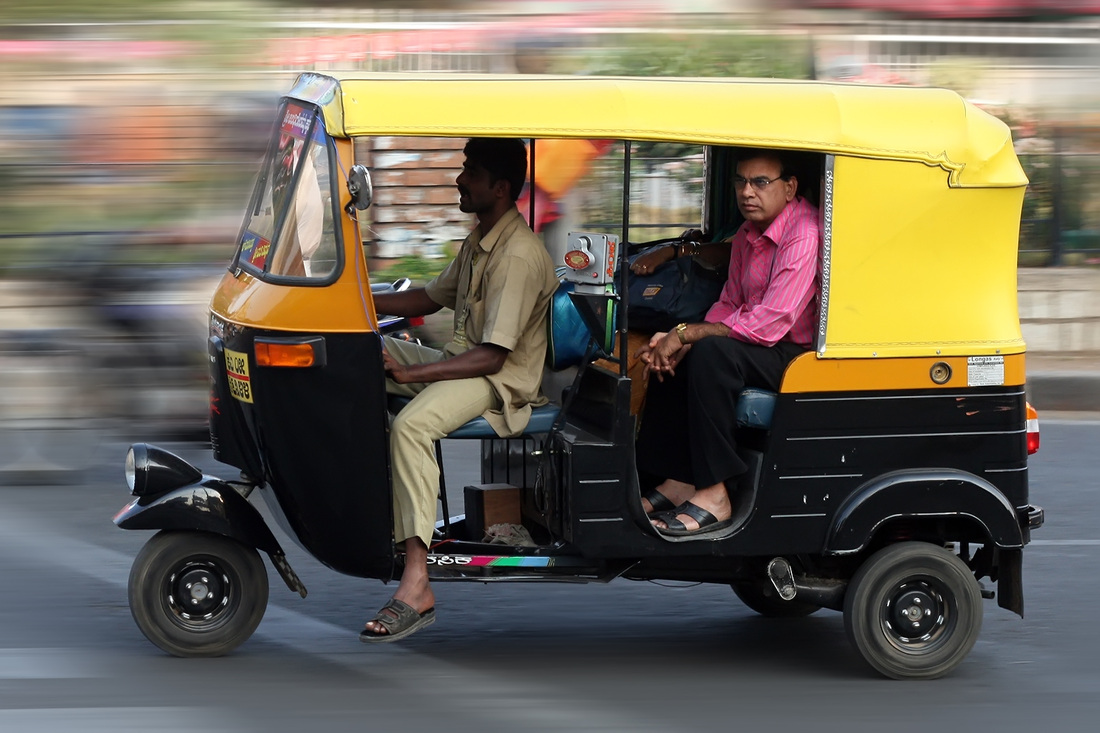
Taxis and rickshaws:
Taxis and rickshaws in Mumbai are required by law to run on compressed natural gas, and are a convenient, economical, and easily available means of transport. Mumbai had about 1.53 million vehicles in 2008, 56,459 black and yellow taxis, and 102,224 auto rickshaws, as of 2005.
Airport:
Chhatrapati Shivaji International Airport
Ports:
-Mumbai Port Trust
-Jawaharlal Nehru Port Trust
Sources:
http://en.wikipedia.org/wiki/Mumbai#Transport
Rail:
The Mumbai Suburban Railway, popularly known as Locals forms the backbone of the city's transport system
Bus:
Mumbai's bus services carried over 5.5 million passengers per day in 2008. Public buses run by BEST cover almost all parts of the metropolis, as well as parts of Navi Mumbai, Mira-Bhayandar and Thane.
Taxis and rickshaws:
Taxis and rickshaws in Mumbai are required by law to run on compressed natural gas, and are a convenient, economical, and easily available means of transport. Mumbai had about 1.53 million vehicles in 2008, 56,459 black and yellow taxis, and 102,224 auto rickshaws, as of 2005.
Airport:
Chhatrapati Shivaji International Airport
Ports:
-Mumbai Port Trust
-Jawaharlal Nehru Port Trust
Sources:
http://en.wikipedia.org/wiki/Mumbai#Transport
Utilities
Under colonial rule, tanks were the only source of water in Mumbai. Many localities have been named after them. The BMC supplies potable water to the city from six lakes, most of which comes from the Tulsi and Vihar lakes. The Tansa lake supplies water to the western suburbs and parts of the island city along the Western Railway. The water is filtered at Bhandup, which is Asia's largest water filtration plant. India's first underground water tunnel is being built in Mumbai.
About 700 million litres of water, out of a daily supply of 3500 million litres, is lost by way of water thefts, illegal connections and leakages, per day in Mumbai. Almost all of Mumbai's daily refuse of 7,800 metric tonnes, of which 40 metric tonnes is plastic waste, is transported to dumping grounds in Gorai in the northwest, Mulund in the northeast, and to the Deonar dumping ground in the east. Sewage treatment is carried out at Worli and Bandra, and disposed of by two independent marine outfalls of 3.4 km (2.11 mi) and 3.7 km (2.30 mi) at Bandra and Worli respectively.
Electricity is distributed by Brihanmumbai Electric Supply and Transport (BEST) in the island city, and by Reliance Energy, Tata Power, and Mahavitaran (Maharashtra State Electricity Distribution Co. Ltd) in the suburbs. Consumption of electricity is growing faster than production capacity. The largest telephone service provider is the state-owned MTNL, which held a monopoly over fixed line and cellular services up until 2000, and provides fixed line as well as mobile WLL services.
Cell phone coverage is extensive, and the main service providers are Vodafone Essar, Airtel, MTNL, Loop Mobile, Reliance Communications, Idea Cellular and Tata Indicom. Both GSM and CDMA services are available in the city. Many of the above service providers also provide broadband internet and wireless internet access in Mumbai. Mumbai has highest number of internet users in India with 14.3 million users.
Sources:
http://en.wikipedia.org/wiki/Mumbai#Utility_services